|
This Digital Terrain Model (DTM)
was created in 1992-93 with a component of Softdesk, Inc., a
civil engineering program. The software assisted transferring
the digitized elevation data (contour lines) from a series of
1:2000 topographical maps to create a simulated landscape in
three dimensions. This process was done for ca. 35 square kilometers,
which is the entire area of coverage for the 1:2000 topographic
maps. This created a large DTM, which was based on a 20 meter
square grid with 5 meter segments.
An example of such a smaller DTM
was created to assist in the understanding of the topography
of the ancient Greek and Roman city. In the late nineteenth
and early twentieth centuries, during the early years of the
excavations at Corinth, a huge excavation dump created an artificial
peninsula of land that extended from Temple Hill (where the
Temple of Apollo sits) out to the north. The total length of
the artificial mound is approximately 200 meters and its maximum
height is approximately 15 meters. In the modern day, the excavation
dump literally obscures a clear view of the nature of the topography
of the ancient landscape. The lab created two DTM's to study
the area surrounding the excavation dump.
First, a DTM was built from the
contours of the topographic map, reflecting the appearance of
the area in the modern day (Fig. 1). The contour lines were
then connected to the east and west of the artificial peninsula
of land to create what may be a reasonable model of the landscape
before the excavation dump was created (Fig. 2). It is the Corinth
Computer Project's hope to study the modified landscape and
the DTM to better understand the ancient city.
The next figure (Fig. 3) clearly illustrates how immense the
excavation dump was when it was created during excavation of
the forum area in the late 19th and early 20th century. The
next figure shows the excavation dump as it appears today, as
a major manmade topographic feature (Fig. 4).
The lab has used Autodesk Inc. 3D Studio MAX to generate renderings
and animations of the DTM of the 35 square kilometer area of
Corinth, some including the colonial and Roman grid, the Greek
city walls and the area from Acrocorinth in the south to the
the Gulf of Corinth in the north.
These images have assisted in
the re-creation of the landscape and are especially useful in
demonstrating gross topographic features. A static 3D model
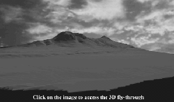
of the landscape looking south from the Gulf of Corinth was
created, the lab then produced a 3D "fly through" movie. (Fig.
5) A further reconstruction of the ancient landscape was created
by combining the three dimensional terrain with the location
of the Roman colony, Greek city walls, and Roman land division.(Fig.
6).
|
;)
;)
;)
;)
;)